Land Clearing & Excavation in Valdosta, GA
Clearing, forestry mulching, grading and site work on lots, acreage and build sites across South Georgia — planned around what the ground has to do afterwards.
Call the tracking line: (229) 414-7539
- ✔ Free on-site estimates — we walk the parcel before quoting
- ✔ Written scope: clearing level, debris method and grading stated separately
- ✔ Georgia requires a land disturbance permit once you disturb 1.0 acre
- ✔ A 25-foot buffer applies along state waters unless EPD grants a variance
Our Excavation & Land Clearing
A dedicated page for every service we offer across Valdosta & Lowndes County.
Land Clearing in Valdosta, GA
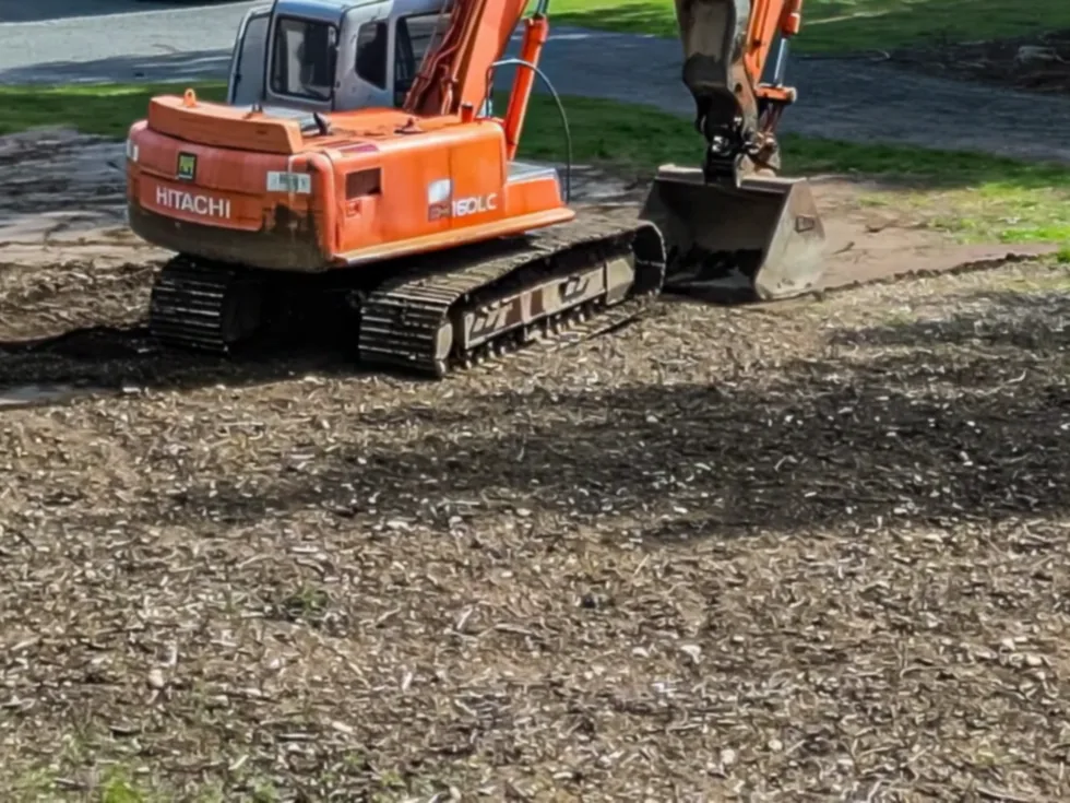
Clearing wooded lots, overgrown acreage and building sites across Lowndes County — from selective thinning to a graded, build-ready pad.
Learn more →Forestry Mulching in Valdosta, GA
A single-machine method that grinds standing brush and small trees into a mulch layer on site — no burning, no hauling, minimal ground disturbance.
Learn more →
Site Prep & Grading in Valdosta, GA
Turning cleared ground into a stable, drained, build-ready surface — building pads, slab prep, cut and fill, and finish grading.
Learn more →Driveways & Culverts in Valdosta, GA
Cutting, shaping and surfacing access on rural and residential parcels — driveways, farm roads, turnarounds and culvert crossings.
Learn more →Ponds & Drainage in Valdosta, GA
Shaping water on the parcel — pond excavation and cleanout, swales, ditching, and drainage correction on wet or poorly shedding ground.
Learn more →Demolition & Debris Removal in Valdosta, GA
Taking down and hauling out — outbuildings, mobile homes, slabs, fencing, storm debris and accumulated material on rural parcels.
Learn more →Stump Grinding in Valdosta, GA
Removing stumps left behind after felling — grinding below grade so ground can be mowed, planted, fenced or built on.
Learn more →Right-of-Way & Fence Line Clearing in Valdosta, GA
Cutting and maintaining linear corridors — fence lines, property boundaries, utility and access right-of-way, trails and firebreaks.
Learn more →Land Clearing & Excavation in Valdosta and Lowndes County — What to Know Before You Start
Start with what the ground has to do afterwards
Almost every disappointing clearing or excavation job in South Georgia traces back to the same missing conversation. Someone asked what it costs to clear an acre, got a number, and found out afterwards that the number bought a different outcome than the one they needed. "Cleared" is not one thing — it describes at least four different levels of work that differ in price by multiples, and the only way to choose between them is to start from what the ground is going to have to do once the machines leave.
If the answer is pasture, sight lines, hunting lanes or firebreaks, the work is vegetation control and the roots can stay. If the answer is a slab, a barn, a shop or a road, the root mass has to come out and the surface has to be shaped to drain, which is a substantially bigger job. If the answer is "I am not sure yet", that is worth saying out loud, because the cheapest sequence is usually to do the lighter work now and the heavier work only where you eventually build.
This page sets out how that decision actually gets made on Lowndes County ground: the four clearing levels and what each one leaves behind, why the soils and geology here change the calculation, what happens to the debris and why that line usually moves the price more than acreage does, and what Georgia law requires before anyone starts. None of it is complicated. It is just rarely explained before the estimate.
The four levels of clearing, and what each one leaves you
Selective clearing takes out specific trees and understorey and leaves the canopy you want. It is the usual choice on wooded homesites where the shade was half the reason for buying the lot, and on managed timber ground where a thinning is the objective rather than a conversion.
Forestry mulching grinds standing vegetation into a chip layer where it stands and spreads it across the working surface. One machine cuts, processes and spreads in a single pass, which removes the three cost centres that usually dominate a clearing job: gathering, loading and hauling. It leaves the root systems in the ground, which is exactly right for erosion control and exactly wrong for building.
Grubbing goes after the root mass, pulling stumps and roots out rather than reducing what is visible above grade. Grub-and-grade adds the shaping step: after the roots are gone, the surface is cut, filled, compacted and sloped so water leaves the structure rather than collecting against it. That final combination is what a slab, a footing or a road base actually requires, and it is the only one of the four that produces build-ready ground.
The trap is buying mulching and expecting grub-and-grade. A mulched parcel looks transformed on the day and is genuinely useful for a long list of purposes — but you cannot pour on it, because the roots underneath will decay over the following years and the ground will settle unevenly as they do. Anyone who tells you otherwise is either misunderstanding the method or hoping the question does not come up.
South Georgia ground: sandy soils over a solution-riddled aquifer
Lowndes County sits in the Southern Coastal Plain, and the soils are characteristic of it. The Tifton series — designated Georgia's official state soil — dominates the province, occupying more than seventy-five per cent of its lower and eastern portion, and typically presents around eleven inches of dark grayish-brown loamy sand over sandy loam. In the southern part of the county and into neighbouring Echols County, the USDA maps the Valdosta series, which it describes as somewhat excessively drained with rapid permeability.
For earthwork, that combination is easy to dig and hard to predict. Water moves downward through this ground quickly rather than running across it, so a site can look dry at the surface and still go soft under a loaded machine. Open-cut sidewalls do not stand the way they do in clay. And fill placed without proper compaction in lifts will consolidate unevenly later, which is a problem that surfaces years after the concrete has cured.
Underneath sits the reason this region has the water it does. The principal artesian aquifer here is a limestone of Eocene to Miocene age, and it is the main water supply for Brooks, Lowndes and western Echols counties. It is also solution-riddled: the U.S. Geological Survey records that the Withlacoochee River north of Valdosta contributes on the order of 112 cubic feet per second into caverns and sinkholes that recharge it. That is a documented, direct connection between the surface and the drinking-water aquifer.
Two practical consequences follow. First, voids, unexpected rock and sinkhole-prone ground are genuine possibilities on this landscape rather than theoretical ones, and a contractor who has never mentioned the possibility has not thought about your site. Second, sediment control here is not a paperwork exercise. On ground this permeable, sitting above an aquifer recharged through open solution features, what leaves a disturbed site in a heavy rain has a short path to somewhere that matters.
Debris: the line that actually moves the price
On most clearing jobs the largest single variable is not cutting — it is what happens to the material afterwards. There are three common routes and they do not cost remotely the same. Mulching in place converts everything to a chip layer and eliminates hauling entirely, which usually makes it the cheapest outcome. Windrowing pushes debris into rows at the edge of the work; it is fast, but those rows permanently occupy part of the parcel. Hauling off produces the cleanest result and costs the most, because it turns a clearing job into a trucking job priced by load and by distance.
Burning is the fourth route and the one that most often surprises people, because it is regulated rather than free. Open burning of vegetative material in Georgia is subject to state and local rules that vary by season and by county, and a Georgia Forestry Commission burn permit is generally required. Any estimate that quietly assumes the pile will simply be lit should be able to say which permission that depends on.
The practical advice is simple: ask for the debris method to appear on the written estimate as its own line rather than folded into a single per-acre figure. When two quotes for the same parcel differ sharply, the difference is usually hiding either in that line or in a different unstated assumption about clearing level.
What Georgia requires before anyone starts
Georgia treats clearing and grading as regulated activity. State law expressly lists clearing, dredging, grading, excavating, transporting and filling of land as land-disturbing activities, and anyone taking part in them is required to be certified under the Georgia Erosion and Sedimentation Act. The credential is the Georgia Soil and Water Conservation Commission's Level 1A certification — widely called the "blue card" — earned by completing an eight-hour course and passing its examination, and valid for three years. It covers the Act itself, NPDES permits, stream buffers and erosion control practice.
Once a project disturbs 1.0 acre or more, a land disturbance permit is required, together with coverage under the NPDES construction general permit and an approved erosion, sedimentation and pollution control plan in place before disturbance begins. Lowndes County administers its own Soil Erosion and Sedimentation Control Ordinance and publishes technical standards and permit packages alongside the state requirement.
Separately and regardless of acreage, Georgia establishes a 25-foot buffer along the banks of all state waters, measured horizontally from the point where vegetation has been wrested by normal stream flow or wave action. Land disturbance and vegetation trimming are restricted inside that buffer, and working within it requires a variance from the Georgia Environmental Protection Division. Because the buffer attaches to disturbance rather than to any particular machine, it applies to forestry mulching just as it applies to a track hoe.
These requirements apply to the work, not to any one company — they govern whoever performs it. It is reasonable to ask any contractor you are considering, this one included, to show a current Level 1A certification and proof of insurance on the proposal before work begins, and to set out the erosion control measures in writing. A fuller plain-English walkthrough is on our permits and rules page.
Why this work is busy in Lowndes County
Lowndes County had a population of 118,251 at the 2020 Census, anchored by Valdosta, Moody Air Force Base and Valdosta State University. Moody is one of the area's leading employers, with its main installation entirely within the county. That base of steady population supports a continuous flow of residential lot work, homesites on rural acreage, driveways and small commercial pads.
The rural economy drives a second and quite different stream of work. Extensive pine plantations make forestry a primary land use — the county administers both a Timber Harvesting Ordinance and a timber tax — which generates recurring post-harvest cleanup, replant preparation and firebreak maintenance. Agriculture accounted for 97 per cent of farm sales in the county in 2022, so pasture reclamation, field edges, ditching and farm road work are ordinary rather than occasional.
The practical effect is that "excavation and land clearing" here covers a genuinely wide range: a quarter-acre lot inside the city and a forty-acre plantation tract after a harvest are the same trade and often the same crew, but they are not the same job and they should not be quoted the same way.
What a written estimate should tell you
A comparable estimate states the acreage and where its boundaries run, the clearing level for each area, the debris method as its own line, whether stumps and root mass are included or excluded, whether any grading or shaping follows, who is responsible for the land disturbance permit and the erosion control plan if the project reaches an acre, and how any state-waters buffer on the parcel is being handled.
We do not publish per-acre pricing on this site, and we would treat any that you find with care. Density, stem size, terrain, access, debris route and clearing level move the real number so far that a headline rate mostly serves to get a machine onto the property. The honest version is a walkover and a written scope. Tell us the parcel and what it needs to do afterwards on the estimate form, and we will follow up with next steps.
Frequently Asked Questions
What is forestry mulching, and how is it different from land clearing?
Forestry mulching grinds standing brush and small trees into a chip layer where they stand, using one machine that cuts, processes and spreads in a single pass. Land clearing is the broader job and can go much further — up to removing stumps and root mass and reshaping the surface. The critical difference is underground: mulching deliberately leaves root systems in place, which is good for holding soil but means the ground is not ready to build on.
What does land clearing cost per acre?
We do not publish a per-acre rate, because the honest range is wide enough that a headline number mostly serves to get a machine onto your property. What actually moves the price is stem density and size, terrain and access, how far down you need to go, and above all what happens to the debris — mulching in place, windrowing, or hauling off are three very different costs. A walkover and a written scope with those items priced separately is the only comparison worth making.
How long does it take to clear an acre?
It depends far more on what is standing than on the acreage. Light brush and scrub move quickly; dense mixed hardwood with large stems is slower by a wide margin, and grubbing stumps out is slower again than mulching over them. Terrain, wet ground and access all affect it. Any estimate of duration should come after someone has seen the parcel.
Do you haul the debris away, or is it mulched in place?
Either, and it is usually the single biggest line in the estimate. Mulching in place converts everything to a chip layer and removes hauling entirely. Windrowing pushes debris into rows at the edge of the work, which is fast but permanently occupies part of the parcel. Hauling off gives the cleanest result and costs the most, because it becomes a trucking job priced by load and distance. Ask for the method to appear as its own line rather than folded into a per-acre figure.
What happens to the stumps and root balls?
That depends on which service you are buying. Forestry mulching leaves them in the ground. Stump grinding reduces the visible stump below grade but leaves the lateral roots. Grubbing pulls the root mass out, which is what has to happen before anything structural goes on the ground. If a slab, footing or road base is planned, the written scope should say explicitly that stumps and root mass are being removed rather than buried.
Can I build on land that has been forestry mulched?
Not without further work. The roots are still there, and as they decay over the following years the ground settles unevenly — which is exactly what a slab or footing cannot tolerate. Mulched ground is well suited to pasture, sight lines, trails, firebreaks and food plots. For a building pad the root mass has to be grubbed out and the surface cut, filled, compacted and graded to drain.
What is the difference between grading, grubbing and mulching?
Mulching reduces standing vegetation to chips and leaves roots in place. Grubbing removes the root mass from the ground. Grading shapes the resulting surface — cutting high ground, filling low ground, compacting it and sloping it so water moves away from where you are building. A build-ready pad generally needs all three in that order.
Do I need a permit to clear land in Lowndes County?
Once a project disturbs 1.0 acre or more, Georgia requires a land disturbance permit, coverage under the NPDES construction general permit, and an approved erosion, sedimentation and pollution control plan in place before disturbance begins. Lowndes County administers its own Soil Erosion and Sedimentation Control Ordinance alongside the state requirement and publishes technical standards and permit packages. Below an acre the permit trigger does not apply, but the state-waters buffer still does, and local rules can differ — confirm with the county for your specific parcel.
Is a licence required to do land clearing in Georgia?
Georgia does not issue a state contractor licence for land clearing or grading as a trade, but it does require certification for the activity. State law lists clearing, dredging, grading, excavating, transporting and filling of land as land-disturbing activities, and anyone taking part in them must be certified under the Georgia Erosion and Sedimentation Act. The credential is the Georgia Soil and Water Conservation Commission Level 1A certification — an eight-hour course and examination, valid for three years. Ask any contractor to show a current one on the proposal.
Can you clear land that is wet, or near a creek or pond?
Georgia establishes a 25-foot buffer along the banks of all state waters, measured horizontally from the point where vegetation has been wrested by normal stream flow or wave action. Land disturbance and vegetation trimming are restricted inside that buffer, and working within it requires a variance from the Georgia Environmental Protection Division. The buffer attaches to the disturbance, not to the machine, so it applies to forestry mulching just as it applies to an excavator. Where a parcel has a creek, pond or wetland edge, that question should be settled in writing before work starts.
Can we just burn the debris pile?
Burning is regulated rather than free. Open burning of vegetative material in Georgia is subject to state and local rules that vary by season and by county, and a Georgia Forestry Commission burn permit is generally required for outdoor burning. If an estimate assumes the pile will simply be lit, it is fair to ask which permission that depends on.
Is sinkhole risk a real concern around Valdosta?
The regional geology makes it worth asking about. The principal artesian aquifer beneath this area is a limestone of Eocene to Miocene age, and the U.S. Geological Survey has documented the Withlacoochee River north of Valdosta contributing on the order of 112 cubic feet per second into caverns and sinkholes that recharge it. Solution features in limestone are by definition places where water has already found a route downward, so voids and unexpected rock are genuine possibilities on this landscape. We are not able to tell you the likelihood on a specific parcel — that is a geotechnical question — but a contractor who has never raised it has not thought about your site.
Will the equipment tear up my property?
Some disturbance is unavoidable, but the amount is a choice. Forestry mulching is comparatively gentle because the machine is not pushing soil around and the chip layer it leaves holds the surface through the next heavy rain. Blade work and grubbing disturb far more by design. On the rapidly permeable sandy soils common in this county, ground that looks dry at the surface can still go soft under a loaded machine, so timing and route planning matter as much as machine choice.
Do you work on timber tracts and pine plantation, or only residential lots?
Both. Forestry is a primary land use in Lowndes County — the county administers a Timber Harvesting Ordinance and a timber tax — so post-harvest cleanup, replant preparation, firebreaks and hunting lanes are ordinary work here, as are residential lots inside Valdosta and homesites on rural acreage. They are the same trade and often the same crew, but they are not the same job and should not be quoted the same way.
Do you offer free estimates, and do you need to walk the property first?
Estimates are free, and yes — walking the parcel is the point. Density, stem size, terrain, access, the debris route and how far down you need to go all move the real number more than acreage does, and none of them can be judged from a map. Send the parcel details and what the ground needs to do afterwards through the estimate form and we will follow up with next steps.
Request your free quote
Tell us about the parcel — no pressure, no obligation. Acreage, what is standing on it, and what the ground needs to do afterwards is enough to start.
Or call now (229) 414-7539Thank you — request received
We’ve received your request and will follow up with next steps shortly.
Need us sooner? Call (229) 414-7539